These Case Studies highlight the breadth of activity carried out by Charter signatories across Scotland. Additional case studies are welcome, please contact Angus Miller (secretary@scottishgeologytrust.org) for further information.
Further examples of Scotland’s Geodiversity Charter in action
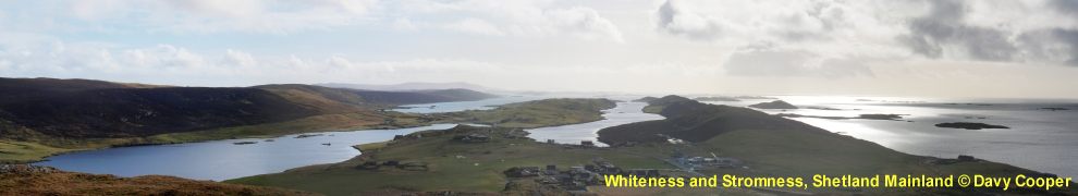
 Scotland’s Geoparks: helping local communities to benefit from their internationally important geoheritage
Scotland’s Geoparks are areas of important and valuable geodiversity, where local communities are working in a variety of ways to promote their local geology and landscapes for tourism, and to enhance awareness of environmental and sustainability issues.
In 2015, the member states of UNESCO (the United Nations Education, Scientific and Cultural Organisation) ratified the creation of a new label, the UNESCO Global Geoparks, to promote the importance of managing outstanding geological sites and landscapes in a holistic manner. Scotland has two UNESCO Global Geoparks, in Shetland and the North West Highlands.
Case Study: Scotland’s Geoparks (pdf file, 2.0MB)
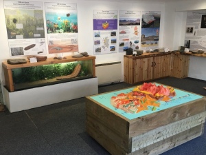
 Valuing Geodiversity in Edinburgh and the Lothians – Designating Local Geodiversity Sites
Local Geodiversity Sites are a springboard for valuing, interpreting and celebrating geology in local communities. Local Authorities – working in partnership with regional and national expertise – can designate sites and include them in Local Development Plans to ensure recognition of their value for education, recreation and in supporting biodiversity. Over 100 Local Geodiversity Sites have been identified throughout Edinburgh and the Lothians over 25 years, the result of collaboration between Local Authorities, volunteers and the British Geological Survey.
Case Study: Local Geodiversity Sites (pdf file, 1.2MB)
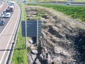 The Queensferry Crossing – Geodiversity in a major infrastructure project
The Queensferry Crossing opened to road traffic in August 2017, part of a major upgrade to the cross-Forth transport corridor in the east ofScotland, representing a total Scottish Government investment of over £1.3 billion. As with any major infrastructure project, geology plays a key role in location, planning and materials used. The bridge design and construction process offered an opportunity to demonstrate this and highlight the variety of local geology. It has also contributed to geoconservation by providing new, permanent and very visible rock cuttings of local sedimentary rocks.
Case Study: The Queensferry Crossing (pdf file, 2.8MB)
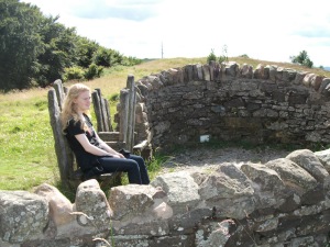
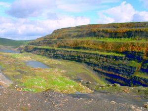 Spireslack Surface Coal Mine: a unique resource for education and recreation
The geology exposed at the Spireslack Surface Coal Mine near Muirkirk in East Ayrshire makes it a unique and stunning geodiversity site, one that can integrate geology with local social and economic history, recreation, and education. While much of the geology of Scotland’s central belt is concealed, the one-kilometre long excavated canyon at Spireslack presents a window into the Carboniferous Period some 330 to 315 million years ago.
Case Study: Spireslack Surface Coal Mine (pdf file, 3.6MB)
